View cart “Furuno US & Canada Pacific Coast, Hawaii, Alaska, Mexico to Panama – C-MAP Mega Wide Chart – MM3-VNA-035” has been added to your cart.
Showing 1–15 of 56 results
-
$19.68 $17.57
Furuno Canada North & East – Vector Charts, 3D Data & Standard Resolution Satellite Photos – Unlock Code – MM3-VNA-021 Canada North & East – Vector Charts, 3D Data & Standard Resolution Satellite Photos – Unlock Code **SYSTEM ID REQUIRED TO RECEIVE UNLOCK CODE** C-MAP Wide Chart – Canada North & East. Vector charts, 3D…
-
$20.15 $17.99
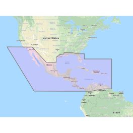
Furuno Central America, Caribbean & Part of Mexico Vector Chart – 3D Data & Standard Resolution Satellite Photos – Unlock Code – MM3-VNA-027 Central America, Caribbean & Part of Mexico Vector Chart – 3D Data & Standard Resolution Satellite Photos – Unlock Code **System Id Number is Required to receive an Unlock Code** C-MAP Wide…
-
$19.03 $16.99
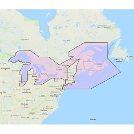
Furuno Great Lakes & Maritimes Vector Charts – 3D Data & Standard Resolution Satellite Photos – Unlock Code – MM3-VNA-026 Great Lakes & Maritimes Vector Charts – 3D Data & Standard Resolution Satellite Photos – Unlock Code **SYSTEM ID NUMBER IS REQUIRED TO RECEIVE AN UNLOCK CODE** C-Map Wide Chart – Great Lakes and Maritimes….
-
$20.10 $17.95
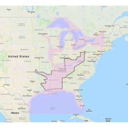
Furuno Gulf of Mexico, Great Lakes & Rivers – Vector Chart & Standard Resolution Satellite Photos for Part of the Great Lakes – Unlock Code – MM3-VNA-023 Gulf of Mexico, Great Lakes & Rivers – Vector Chart & Standard Resolution Satellite Photos for Part of the Great Lakes – Unlock Code **SYSTEM ID REQUIRED TO…
-
$1.95
MM3-FNA-022 C-MAP Fishing Chart US East Coast & Bahamas *Needs System ID# To Process C-Map Fishing Chart ?C US East Coast and the Bahamas. Vector charts. This Chart Pack includes fishing charts for US East Coast and the Bahamas. C-Map chart data is used and converted to the TimeZero format. Note that you will need…
-
$19.42 $17.34
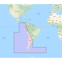
Furuno South America West Coast – Costa Rica to Chile to Falklands Vector Charts – Unlock Code – MM3-VSA-500 South America West Coast – Costa Rica to Chile to Falklands Vector Charts – Unlock Code **SYSTEM ID REQUIRED TO RECEIVE UNLOCK CODE** C-MAP Wide Chart – C-MAP by Jeppesen Charts, Costa Rica to Chile to…
-
$18.98 $16.95
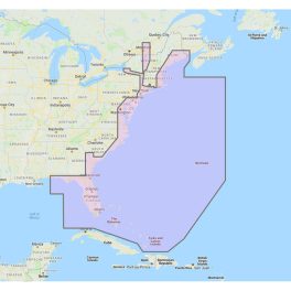
Furuno U.S. East Coast, Bahamas & Bermuda – Vector Charts & Standard Resolution Satellite Photos for Bahamas – Unlock Code – MM3-VNA-022 U.S. East Coast, Bahamas & Bermuda – Vector Charts & Standard Resolution Satellite Photos for Bahamas – Unlock Code **SYSTEM ID NUMBER IS REQUIRED TO RECEIVE AN UNLOCK CODE** This Chart Pack includes…
-
$19.16 $17.11
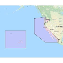
Furuno U.S. West Coast, Hawaii & Baja Mexico – Vector Chart, Standard Resolution Satellite Photos for Baja Mexico – Unlock Code – MM3-VNA-024 U.S. West Coast, Hawaii & Baja Mexico – Vector Chart, Standard Resolution Satellite Photos for Baja Mexico – Unlock Code **SYSTEM ID REQUIRED TO RECEIVE UNLOCK CODE** C-MAP Wide Chart – U.S….
-
$32.42 $28.95
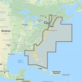
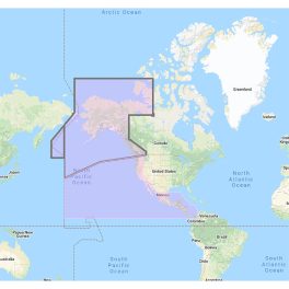
Furuno US & Canada Atlantic Coast, Gulf of Mexico, Caribbean Bahamas and central America Vector Charts – Unlock Code – MM3-VNA-033 U.S. & Canada Atlantic Coast, Gulf of Mexico, Caribbean, Bahams and Central America Vector charts, 3D data & standard resolution satellite photos – Unlock Code **SYSTEM ID REQUIRED TO RECEIVE UNLOCK CODE** C-Map Mega…
-
$31.48 $28.11
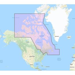
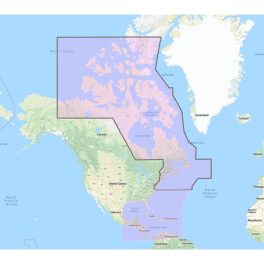
US & Canada Pacific Coast, Hawaii, Alaska, Mexico to Panama – C-MAP Mega Wide Chart C-MAP Mega Wide Chart – U.S. & Canada Pacific Coast, Hawaii, Alaska, Mexico to Panama. Vector charts, 3D data & standard resolution satellite photos. This Chart Pack includes vector charts, 3D data and standard resolution satellite photography for the US…
-
$8.03
LakeV?? g3 – LUS100F – microSD/SD The Advanced Freshwater Fishing Map Industry-leading coverage, clarity and detail with updated inland maps that feature integrated Garmin and Navionics content Coverage for more than 17,000 total lakes with up to 1?? contours that provide clearer lake floor views, so you can catch more fish Auto Guidance1 technology quickly…
-
$6.73
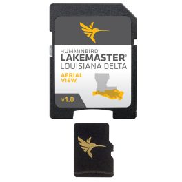
Humminbird LakeMaster Aerial Satellite View – Louisiana Delta – LakeMaster Aerial Satellite View – Louisiana Delta Humminbird LakeMaster now offers high resolution aerial photography of the Louisiana Delta on one micro card (with SD adaptor). Always know where you are with real life aerial views of shorelines, waterways, landmarks, obstructions, roads, marinas, canals, and channels….
-
$4.95
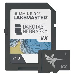
Humminbird LakeMaster VX – Dakotas/Nebraska – 601001-1 LakeMaster VX – Dakotas/Nebraska An upgraded mapping solution in Humminbird LakeMaster VX to help anglers understand what is under the water??s surface better than ever before. For decades, Humminbird LakeMaster has led the charge with the most accurate and advanced mapping available for anglers. Now, LakeMaster is taking…
-
$4.77
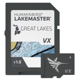
Humminbird LakeMaster VX – Great Lakes – 601002-1 LakeMaster VX – Great Lakes An upgraded mapping solution in Humminbird LakeMaster VX to help anglers understand what is under the water??s surface better than ever before. For decades, Humminbird LakeMaster has led the charge with the most accurate and advanced mapping available for anglers. Now, LakeMaster…
-
$4.56
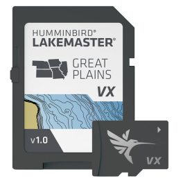
Humminbird LakeMaster VX – Great Plains – 601003-1 LakeMaster VX – Great Plains An upgraded mapping solution in Humminbird LakeMaster VX to help anglers understand what is under the water??s surface better than ever before. For decades, Humminbird LakeMaster has led the charge with the most accurate and advanced mapping available for anglers. Now, LakeMaster…